Did you know that there are underground bridges in the city?
You say – «Den, what kind of fables?» And they really are, and I saw them with my own eyes, and even some of you who went to the city dungeons saw them, but did not understand what exactly you were looking at.
Eh … I wanted to write a short post about our tour to the old sewer, but it doesn’t work in short. )))
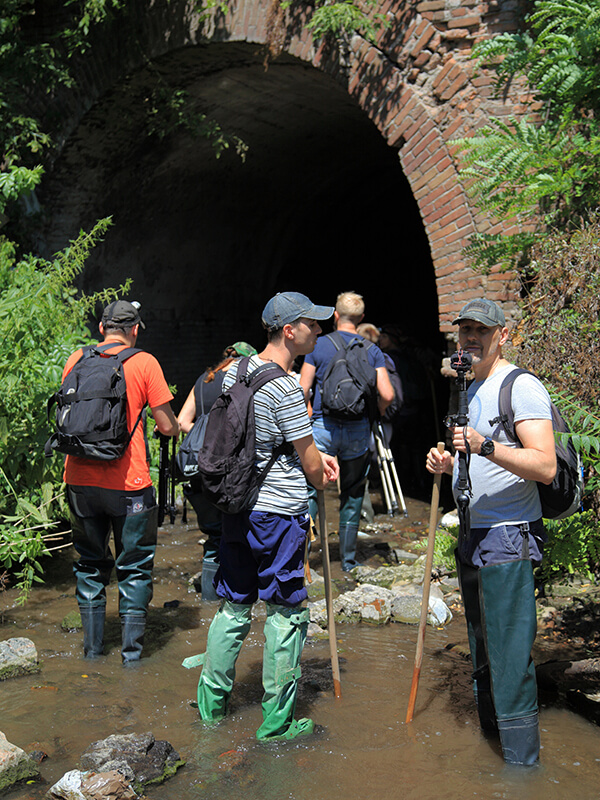
1. Photo by Vadim Ponomarenko. Our group in front of the entrance to the collector portal under the street. South - this is what old bridges would look like
Photo by Artyom Kostyuk. We are ready for adventure.
I did not make a «discovery» – historians, local historians and researchers of the Dnieper have long known about these structures, there was simply no reason to talk about them. For example, Artyom Kostyuk bothered with this topic even before me, here is his post on this topic.
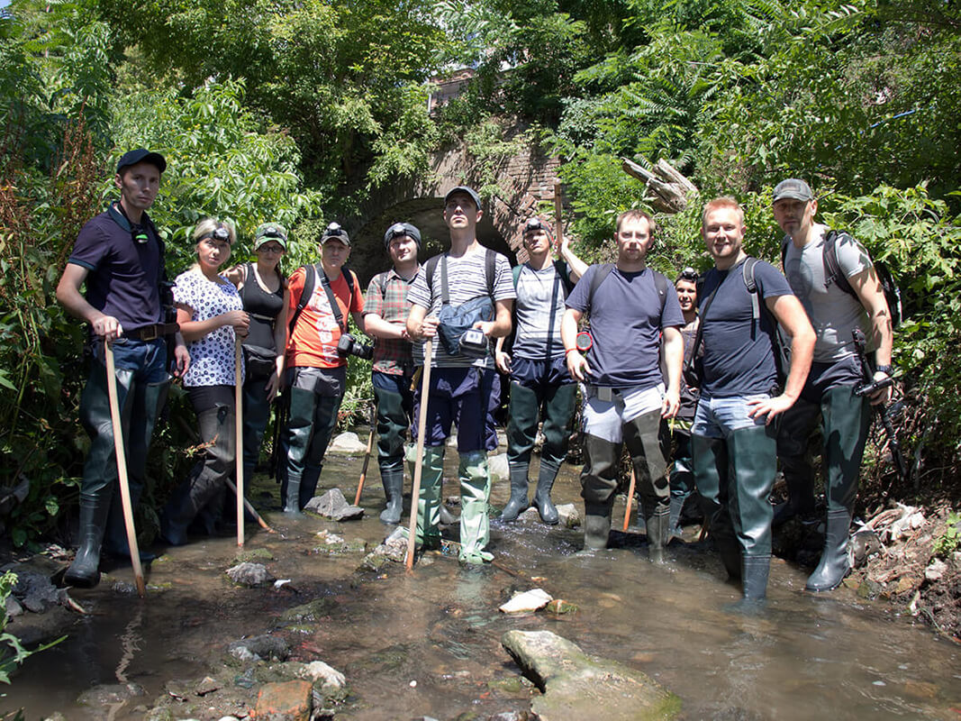
Artyom went with us this time as well. Here is our group photo by Artyom before we went to the sewer. From left to right: Vadim (industrial photographer), Masha (follower), Dina (follower), Alexander (photographer-videographer), Dmitry (follower), Pyotr (digger), Andrey (air traffic controller), Roma (blogger, urban explorer), Stas (tourist guide), Artyom (blogger, urban explorer), Den (sort of like me).
I have long wanted to get into this engineering structure, but there was no chance to fulfill my desire. By the time of my «immersion», I had already «pumped up» myself with some knowledge of this river and these dungeons, so I already knew roughly what to pay attention to.
There were several photographers with us, so I went into the dungeons with a video camera and focused on filming and commenting on what I saw (I will attach links to my videos below).
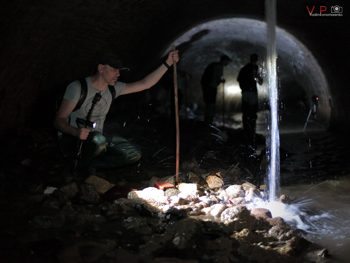
3. Photo by Vadim Ponomarenko. Den Weissmann studies the limescale on the rocks. Location: collector area under "Grand Plaza"
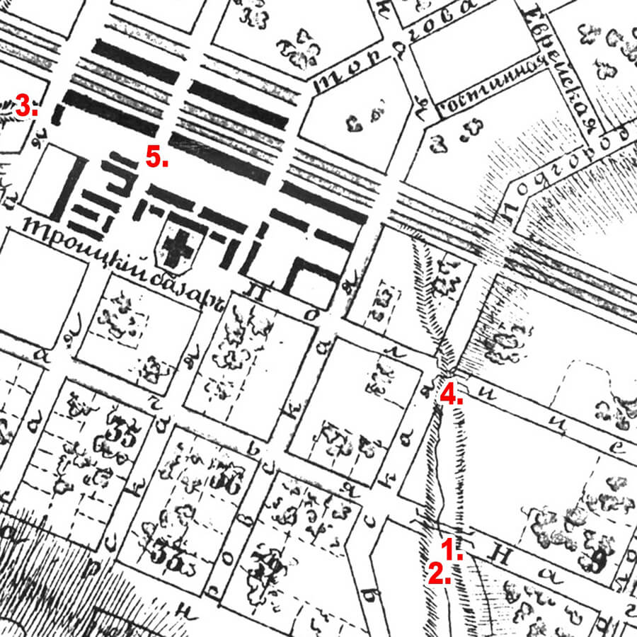
Trinity Market - 1870s scheme Previously, this market was located in the quarters near the Holy Trinity Cathedral. The diagram shows the bed of the Gendarme ditch and some bridges across it.
These bridges were once on the surface and everyone could see and use them. They still exist, and still perform their functions, but you will not see them in the urban environment – they have become part of the underworld – or rather, part of an old storm sewer.
How did it happen?
It is known that the central part, then Yekaterinoslav, was crossed by several small rivers that flowed along ditches. Through these ditches, at the intersection with some streets, brick bridges were built. Subsequently, the building of the city was compacted, and the ditch between the bridges began to be covered with a brick vault and covered with soil, and built up on top. Thus, the bridges «went underground», and the ditch turned into the famous sewer.
Today, multi-storey modern buildings already stand above these bridges, and the Dnipro metropolis lives a stormy life.
After comparing the footage with the engineering background of the city, I was able to identify almost all underground objects. In this publication, I will show a couple of the most illustrative “underground bridges”.
I enclose a photo of the authorship of my friend, the famous Dnipro industrial photographer Vadim Ponomarenko.
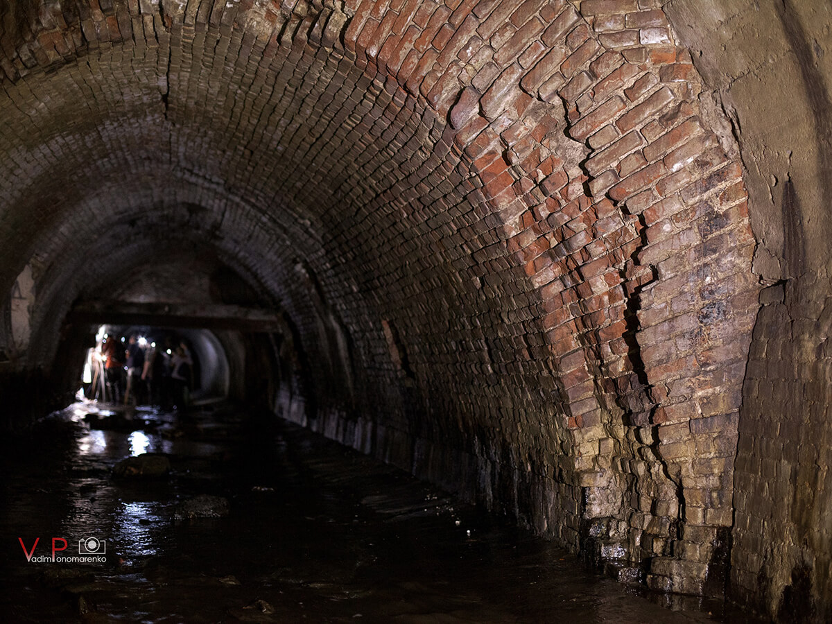
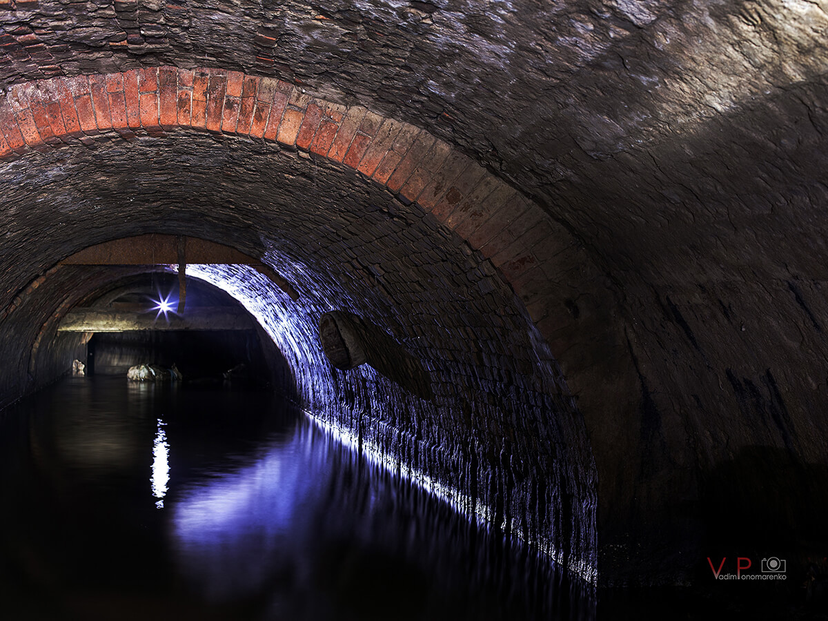
4. Photo by Vadim Ponomarenko. Constructions of the Yekaterinoslav brick bridge of the middle of the nineteenth century. Location: the intersection of Shevchenko street (the old name of Police Street)
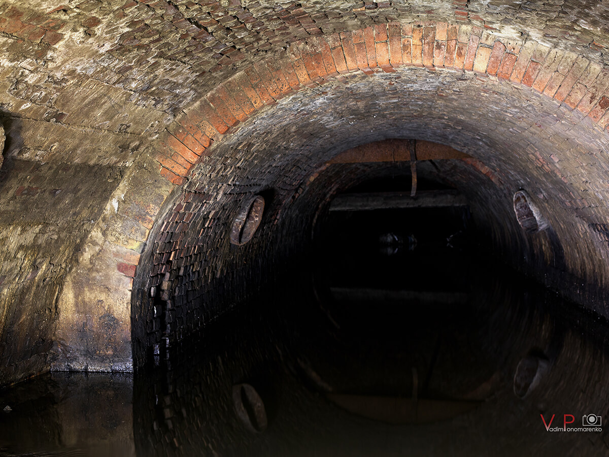
5.1. Photo by Vadim Ponomarenko. Constructions of the Yekaterinoslav brick bridge of the middle of the nineteenth century. Location: bridge under Heroes of Maidan Square
A very clear illustration - here you can see three types of building structures at once
This is a photo of an old bridge that stands (or rather is underground) at the intersection of Yuzhnaya and Shevchenko streets. Because at the very beginning, the storm collector has a high vault and a larger cross section, then the bridge structures here are the most outstanding.
You can see the massive brick arch of the bridge. It is also worth paying attention to the masonry on the right – straight masonry is visible to a height of about 1.5 meters – this was the improvement of the channel of the Gendarme ditch (like a brick fence that prevents shedding and blurring of the banks of the ditch).
Subsequently, a brick vault was erected above it, covering the ditch (the structures of the vault are thinner, so the bridge structures protrude significantly). The fact that the arch of the ditch was erected much later is also evidenced by the concrete lining (namely, “lining”, and not finishing – this is the term used to equip the vaults of tunnels and other underground structures).
The height from the bottom of the ditch to the arch under this bridge is about 3 meters, the height to the arch of the ditch is about a meter higher. Here is a link to the location of this bridge on the satellite and old map.
Here is another interesting photo – 5.1
This photo also clearly shows the structures of the old brick bridge (they are below the arch of the ditch). The height from the bottom of the ditch to the arch under this bridge is a little over 2 meters, the height to the arch of the ditch is about 2.5 meters. Interestingly, an old riveted pipe goes right into the arch of the bridge. And on the diagram of the Trinity Market, it is indicated that the city (Ekaterinoslav) water supply system crashes into one of the bridges – this is one of the factors that helped me identify the location of this bridge. The bridge was located at the intersection of Troitskaya Street and Prospekt – now it is the Heroes of Maidan Square.
Here is a link to the location of this bridge on the satellite and old map. In the photo below, you can better see the tie-in of the old water pipe.
5.2. Photo by Vadim Ponomarenko. Constructions of the Yekaterinoslav brick bridge of the middle of the nineteenth century. Location: bridge under Heroes of Maidan square
Photofixation scheme
I am enclosing a small map of locations based on a fragment of the 1884-1889 map “Plan of the city of Yekaterinoslav“, where these photos were taken. The numbers in the description under the photo correspond to the shooting location.
My result (or rather product) of visiting this old storm sewer is a video. I believe that I managed to shoot the most detailed video recording, with explanations and linking underground locations to the aboveground world. In editing, I got two episodes, about half an hour each.
Also in my videos, I express my doubts and justifications about the toponym of this river. Therefore, if you have an interest and some free time – make yourself some tea, take some sweets and watch my work on the YouTube channel.